Sea Map and Water Sports
About the Sea Map and Water Sports
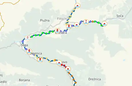
By the switching capability of POIs, the card is good for planning of activities in the water. Thus, for even at small scales important information is good to find. Where are service stations along the route, where can I put my motor boat to water and where are danger points in the water for my canoe, which levels have white water routes, which ports can I reach on my route.
A great advantage of the new water sports card is the ability to switch all POIs. Thus, for example, slipways displayed at similar cards only at very strong zooming. When searching you need this also on a small scale. This also applies to many other POIs such as boat stations, weirs, insertion and exit points for canoes etc.
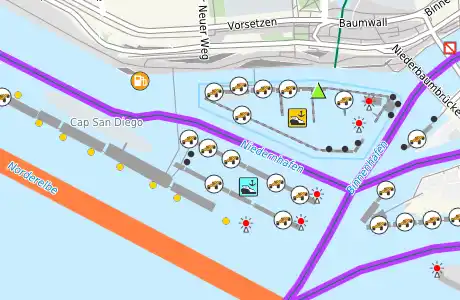
In the planning and organization phase of a recreational activity, the map offers a clear added value. For recreational athletes in general, boaters, power boaters in particular it is helpful to be able to easily determine where its activity is possible. For boaters, where his boat category (not motor, canoe, motorboat) can be used.
The new water sports map for example on motorboaters: It is possible, if the Open Street Mappers have entered everything correctly, to recognize powerboat suitable waterways and nautical POIs (locks, moorings, boat stations, etc.) for planning in the map.
Remember clippings and share them
You can save map sections with the bookmark function of your browser. Here, the map section and all selected POIs and geometries are stored.
You can also easily copy and save the current browser line (URL). The link thus produced can be send to someone. After clicking on this Link the map will open then as you have set it with the switchable POIs.
Change and supplement data
Clicking the right mouse button on the map opens a context menu. From this menu, you can select an editor for OSM, where then the selected map section is opened for editing.
To edit you need a benevolent OSM account, you can create at any time for free.
By using the menu, it is also possible to display an aerial view of the current section.